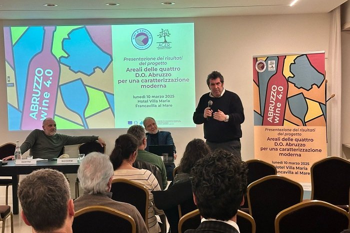
Ado Abruzzo, the Consorzio Tutela Vini d’Abruzzo’s Four D.O. Areals study on the region’s viticultural suitability.
Ado Abruzzo, more than 155 thousand plots, totaling 33,964 hectares under vine, with 118 varieties. Of these, the Montepulciano grape variety presents more than 52 percent. Followed by Trebbiano Toscano with about 14 percent. Then Trebbiano Abruzzese, Pecorino, Chardonnay and the rest.
The Ado Abruzzo study
This is some of the very first information to come out of Ado Abruzzo. “Areals of the four D.O.’s. Abruzzo for a modern characterization”, the study on the characterization of the territories of the four regionally valued appellations, presented March 10 in Francavilla al Mare.
It was led by the Consorzio Tutela Vini d’Abruzzo, with Ager (Agriculture and Research) and the companies agricultural Chiara Ciavolich, Francesco Labbrozzi, Sandro Polidoro, Tenuta i Fauri and Fratelli Cimini, with Funds from the Agriculture Department of the Abruzzo Region, under the program of development Rural 2014/2024 with measures to support the establishment and management of operational groups of the EIP (European Partnership for Innovation) in agricultural productivity and sustainability.
Through the use of modern technologies based on the georeferencing of information and the use of big data, and in particular the use of the Enogis platform, which is capable of integrating different layers of information, the viticultural and oenological suitability of the various territories involved were identified.
President Alessandro Nicodemi’s comment
“The work that has been done with this project,” comments President Alessandro Nicodemi, “Is precise and timely. Dense with data capable of providing a detailed picture of the entire territory. Kudos go to the Consortium’s technical office and all the partners who have worked throughout this first year with great care. The result is viewable by everyone through an intuitive map that can provide really valuable information in agronomic and production choices. All this can only contribute to the enhancement of the quality of our region’s wines. But also in reducing the risks that can result from poor business choices.” .
In the first phase of work, vineyards were mapped starting from the Vineyard records of Abruzzo wineries for the year 2023 provided by the Abruzzo Region. Once the vineyards were georeferenced, data on the ” Soil Map of the Abruzzo Region – A.R.S.S.A..” i.e., the map of soils of the entire territory of the Abruzzo Region at a scale of 1:250,000 made through the synthesis of data collected during the period 1994 – 2006 (region, systems and subsystems) – http://geoportale.regione.abruzzo.it/.
Copernicus data
Using satellite data from the European Copernicus project reprocessed at 2 km from the Bruno Kessler Foundation (FBK) in Trento, Italy, climate maps were made based on data from the last 22 years (2001-2022). The main weather-climate indices to hypothesize the climatic zones most or least suitable for the production of quality wines: with Winkler’s index, for example, the most suitable grape varieties for each zone can be identified, while with the De Martonne index, favorable zones for viticulture were identified in relation to the balance between temperature and precipitation.
The climate in Abruzzo
In Abruzzo, the index is above 20, which overall indicates a sub-humid climate and therefore suitable for vine cultivation. Thanks to the availability of the Region’s Agriculture Department, the results of 47 automatic agro-climatic monitoring stations have been woven into the platform and all of them can be viewed in real time.
Finally, territories were characterized, for each territorial delimitation (region, province, sub-areas, municipalities) by compiling statistics on the distribution of soils and other characteristics such as vineyard exposure, altitude, average slope.
Data on the Consortium website
All information layers have been uploaded to both the consortium website and the https://abruzzodoc.enogis.it/mappe_abruzzodoc/wsgi and are freely available for consultation. In addition, a special module has been developed that provides the ability to view vocational units, and provides useful tips on the map for creating the most suitable facility.
